4. Resolving Issues
4.1. Health Facilities and Settlements
All health facilities and settlements listed in these dropdowns require some kind of additional information. For health facilities, information on facility type or ownership may be required; for settlements, the most common issue is the automatically generated names that were discussed in Machine-Generated Names.
4.1.1. Health Facility Issues
For example:
Aishe Oja Primary Health Center require information on ownership
Babanla Primary Health Care require information on ownership
4.1.2. Settlement Issues
For example:
HA_1028592 needs a proper name
HA_1028112 needs a proper name
These machine-generated names should be replaced with actual settlement names where possible, using information from field surveys, local knowledge, or existing maps.
4.2. Geometry Data Completion
4.2.1. Types of Geometry Issues
Health facilities that are assigned to a neighboring ward
Settlements that are assigned to a neighboring ward
Settlement points that do not intersect with their assigned settlement boundary
These discrepancies need to be reviewed on an individual basis.
4.3. Population Discrepancies
This section shows cases where there are significant differences between field-estimated population and the computed population estimation. You can mark this for review so that others can check whether population values here should be updated.
4.3.1. Managing Population Discrepancies
When field estimates differ significantly from modeled estimates:
Investigate the cause - could be due to:
Recent population growth or decline
Inaccurate settlement boundaries
Seasonal population variations
Errors in field survey data
Decide on appropriate action:
Accept field estimate if recent and reliable
Investigate boundary accuracy
Flag for additional field verification
Use averaged estimate if both sources are uncertain
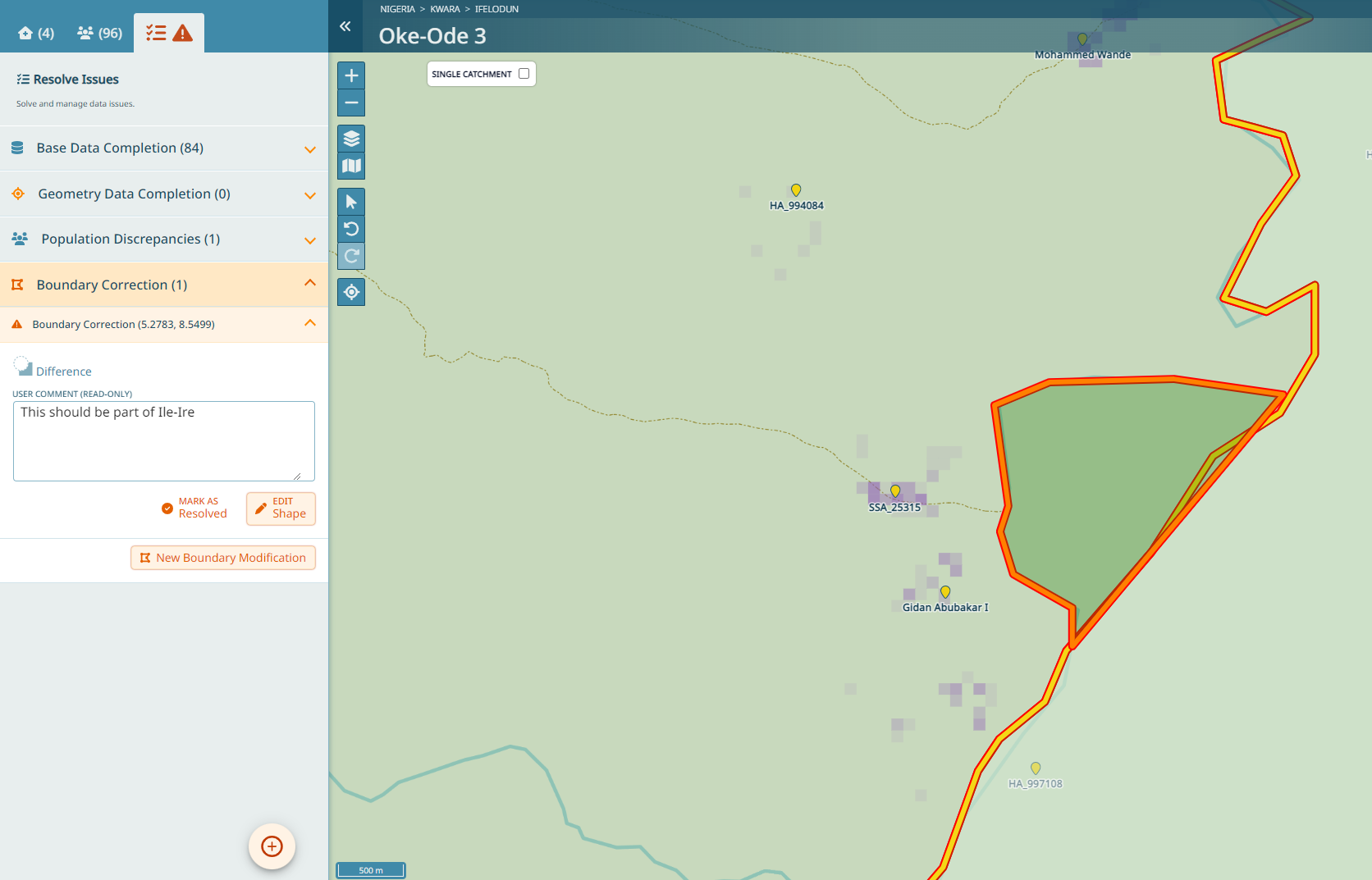
4.4. Boundary Correction
Sometimes, it’s necessary to correct the ward boundaries.
Warning
Boundary corrections should only be done if you are sure there is an error. Where possible, it is always recommended to gain information from the field before updating boundaries.
4.4.1. Boundary Correction Process
Expand the Boundary Correction tab and then click on New Boundary Modification
Follow the instructions in the pop-up box and draw a shape following the river that will modify the operational boundary
Double-click once you have finished the shape
Now you need to select if this part should be added to the ward or subtracted from it. If the delineated part should be part of the neighboring ward you need to subtract it. Click Difference. If the delineated part should be added to the current ward, you need to add it, click Union.
You can optionally add a comment - for instance you can specify where this part should go, in case you know: ‘This should be part of the ward XYZ’ or some such.
If you want to see the modifications you did, you can click on them once they have been created.
Important
Ward boundary changes are applied to a separate boundary layer that is not used for catchment calculations of the ongoing rounds. These corrected boundaries are part of the export and can be used to update the geospatial database for the next round of microplanning.